Skyline Trail Jasper Trip Report
Explore the famous Skyline Backpacking Trail
The Skyline backpacking trail is a world-famous backpacking trail located in Jasper National Park in the Canadian Rockies. It is an absolute must-do if you are into backpacking and hiking. It is one of the classics of the Canadian Rockies. And as we found out – it certainly deserves that title!

The trail is approximately 46 km long and takes about 2-3 days to do. It is really up to you how long you want to spend on the trail, you can take a few extra days and explore the numerous windswept alpine ridges. There are six backcountry campgrounds, each having about 7 sites each, with the exception of Evelyn Creek, which has 4 sites. Though we stayed there the first night, and it appears like they have far more than just the 4 advertised on the Park’s guide.

Planning your route
The trail is very well established and is one of the most scenic backpacking trips you can imagine. Only a small percentage of the trail is located below treeline, only in the beginning of the trail up to Evelyn Creek and at the end when descending past Signal campground. Because the trail is not a loop, there are two options for hiking it: either north to south or south to north. The trail is generally done south to north – from Maligne Lake trailhead to Signal trailhead. This is the recommended route because the Maligne Lake trailhead is higher than the trailhead on the north side. When you hike it from Maligne Lake to the north trailhead on Maligne Lake Road you start 500 meters higher and have more elevation to loose. If you do it the other way, that is, from the signal trailhead up to the Maligne lake trailhead you climb 500 meters higher.
We recommend staying in Jasper at one of the nearby campgrounds or at a hotel

Most of the route is up in the alpine, presenting stunning views of the high mountains in the Park. The campgrounds are located at treeline just below the high alpine. The trail crosses three mountain passes over vast windswept ridges and spectacular high alpine meadows.

If you manage to go on the trip during a period of high pressure and have clear weather, you will have some pretty spectacular views of some amazing high peaks. Mount Charlton (10,555’, 3217m) and Unwin (10,722’, 3268m) to the south, the classic Mount Edith-Cavell (11,033’, 3363m) to the west, and even some of the peaks off the Columbia Icefield further south, such as Mount Alberta (11,873’, 3619m). If it is really clear you will be able to see as far as Mount Robson, the highest peak in the Canadian Rockies which towers above everything around it at 12,972’ (or 3954m)!


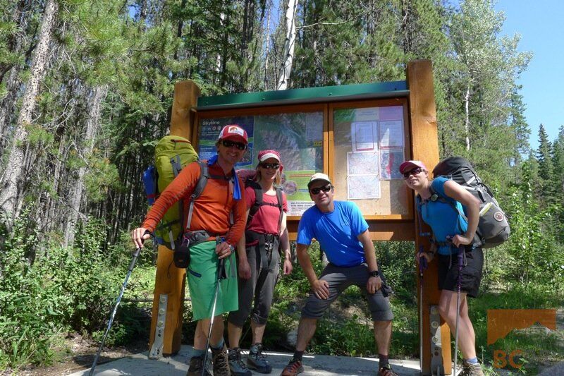
Our Trip
After flooding had ravaged a lot of the mountain parks in Alberta, particularly to the south, our original plans were cancelled and we had few options for the Canada day weekend. Luckily Jasper wasn’t as affected by the flooding and we chose to go there and finally hike the Skyline trail – something we have been wanting to do for awhile – even though we were told it’s still early season conditions on the trail. We weren’t alone in escaping to Jasper, a lot of other hikers and climbers in the area opted to go there that weekend. Booking our sites for the Skyline we were told that the one obstacle on the trail may be crossing the ‘notch’: this is the highest point on the trail at about 2510 meters, where you cross a mountain pass, and tends to hold snow until well into July. This feature keeps the trail impassible early in the season.

Though the trail was apparently booked up and forecast to be super busy, we saw few people on the trip and the hike itself managed to retain a very remote flavour because of it. The trail is very well managed and campsites are small and spread out so you never feel quite overcrowded. Though the trip is described as “semi-primitive,” it felt very remote and wild.

Evelyn Creek
We started late the first day, hiking in only 5 km to the Evelyn Creek campground. This was easy, hiking mostly through forest until the final short climb up the campground, which sits just below treeline and from it where you get a preview of some nice views. Glaciated Mounts Charlton and Unwin are visible from here among many other windswept ridges. The campground has a groundwater spring for water source – either than glacier water, it is hard to imagine water that could be more pure than that. We noticed a few people were filtering this water – definitely unnecessary.

The mosquitos were bad at this campground – but July in the Rockies, and in hot weather, you’re going to get some pretty big bugs. It’s not until you get really high up that they go away, and the wind definitely helps blow them away as well.
Little Shovel Pass
Up the next day excited to hike to the next campground, which we knew would be a little higher and were hoping this would take care of the bugs. We climbed a short bit above the campground and were very quickly up in the alpine, walking through a spectacular alpine meadow up to little shovel pass. Little shovel pass is the first pass you come across and is positioned at 2240 m. The hike up to this pass from the campground is a very easy grade: before we knew it, we were standing on the pass, wind howling, and amazing alpine as far as we could see. The mountains in the area are old, so there is a lot of scree, and a lot of them are very gently sloped. There are opportunities here to walk up from the pass to some summits.

Snow Bowl – Amazing Alpine!
Once we got over the pass, we headed down and were on our way to snow bowl campground. This is a spectacular spot as it is barely below treeline, in a stunning alpine meadow. The area is surrounded by peaks only a few kilometers away. The trail in this high meadow is a true highlight of the trip. You walk for kilometers in this amazing setting: with streams, small trees, rock bluffs and spectacular alpine flowers in bloom. Then we were off over big shovel pass at 2320 m, which is easy and only steepens a tiny bit near the end. Again, views from the pass are wonderful, and there are opportunities to scramble up some more peaks from here.

From big shovel pass it is also possible to pick up a hiking trail and hike back to maligne lake, if you need to cut your trip short. Watchtower trail is about 14.3 km from the pass. If you come early in the year and can’t get over the Notch yet, you can stay at Curator campground and hike out through the watchtower trail back to the lake.
Curator campground is a bit lower down (at 2070 meters), and we considered going to check it out, however, there was too much elevation loss, for just a side trip, and with temperatures close to 30 degrees we were too hot to do any extra hiking. Plus, we enjoyed being up in the alpine where there were few bugs. Curator campground is located about 800 meters off the hiking trail and is popular with hikers who complete the skyline trail in 2 days.

Curator Lake
It was quite hot and we knew that on the way up to the Notch we would be passing next to a high alpine lake, Curator. The desire to cool off was pretty extreme – and overpowered knowing of the severe cold temperature of the lake – likely around 10 degrees! Jumping in the lake was a bit painful, and two of us went in to our thighs and washed our hair, while the other two in our party went in all the way, even diving in headfirst! One in our party even slid down a small remaining snow patch directly into the water. Very brave! It was refreshing, and worth it.


The Notch
Next we tackled our hike up over the notch. From the lake, we had almost 400 meters to gain. It didn’t take long for us to start overheating again climbing up the trail. The Notch holds the last of the snow on the trip, and the snow actually forms a large cornice over the winter that slowly melts out in the spring. The notch is accessed from the east side (hiker’s right), and becomes steep scree. We had to walk over a bit of snow, perhaps 200 meters or so, and the snow steepened near the top, and rolled over on our left hand side. It was a bit steep if you looked over your left, but wasn’t a problem for walking. It was definitely nice to have hiking poles on this section. If you slipped, you could fall a ways down the snow, gain some speed and scratch yourself up on the scree. If you hike it in summer, there will be less and less snow and there will be no problem crossing it.


Being on top of the Notch was another definite highlight. This is the highest point of the trail at 2510 meters, and where the spectacular Mount Edith-Cavell comes into view, and also some of the peaks of the Columbia Icefield, and even Mount Robson if you are lucky enough to have weather like we did. The next section is an amazing walk over a high windswept ridge and is very scenic and enjoyable.


High Tea
We stopped for tea in the alpine before descending down to our campground for the night, at Tekkara. There are a few large snowpatches where we got some drinking water. We tried to spend as much time as possible up here – being afraid to get back down knowing the mosquitos would be waiting for us! The hike down to the campground is where you start loosing a lot of elevation, on a nice switchback trail.


The next day we hiked up slightly uphill again from Tekkara, and again up into a nice alpine meadow, where we walked for hours. It was another hot day, this day the hottest one of the year so far – at 35 degrees – and hiking was very very tiring. We couldn’t wait to go for another swim! Finally, we made it to signal, which is the start of the fire road trail that takes you down to the north trailhead. It felt like a long hike down – our feet were swollen from walking in the heat and our core temperature very high. The trail went on and on and on … until it didn’t – and we were very happy to see our vehicle, which had air conditioning!


The next step was retrieving our vehicle from the other trailhead. This only took about 45 minutes there and back, even with heavy long-weekend traffic.
Then we headed to Lake Annette for a well deserved swim (and hair wash!) to get rid of all the sunscreen and bug spray, and followed that up with a stop for dinner and beer. It was an amazing trip, and I would love to go up there and spend a few more days exploring some of the mountains out there. I would like to try the trip again later in the summer when the nights are cooler and there are no bugs. Though you won’t see the alpine flowers in bloom, which is certainly a must see, you will get crisper nights and more refreshing temperatures.
Tips for hiking the Skyline Trail:
- The trail is in very well graded: you can get away with lighter hiking boots, they are easier on your feet than heavy duty ones
- Book your campsites as far in advance as possible: in summer, spots full up fast!
- Bring lots of bug spray in summer – the mosquitoes and black flies are numerous, typical for this far North
- Try the trail in the fall: bugs will be fewer, and it will be easier to book a campsite last minute
- Hiking the trail in summer you will see amazing alpine wildflowers
- Bring lots of sunscreen
- Spend more time, and hike or scramble some of the summits along the way
- If you are brave … take a dip in Curator lake!
Here is a helpful guide for the trail:
| Kilometer | Directions | UTM Coordinates |
| 0.0 | Start from the trailhead at the north end of Maligne Lake, and hike northwest. | 0456449E 5842191N |
| 4.2 | Continue straight ahead at this 3-way junction, cross Evelyn Creek. | 0452639E 5843216N |
| 9.0 | Crest 2240 m Little Shovel Pass, then descend 2.4 km into the Snowbowl. | 0448417E 5843302N |
| 15.9 | From Big Shovel Pass, fork left and descend northwest toward Curator Lake. | 0449372E 5848055N |
| 18.0 | Turn right at the T-junction, rounding the east side of Curator Lake. Stay left for campsites. | 0442220E 5848971N |
| 21.6 | Spectacular, 360-degree views along the ridge of Amber Mountain. | 0439587E 5850920N |
| 24.3 | Descend switchbacks to a small lake below Centre Mountain. | 0437818E 5852864N |
| 27.4 | Walk on the east side of Tekarra Lake; you’ll find campsites about 700 m ahead. | 0438039E 5854776N |
| 31.7 | Cross creek and contour through meadows below Mt. Tekarra and Signal Mountain. | 0435838E 5857550N |
| 34.0 | Turn right on old Signal Mountain fire road, then descend to Maligne Lake Road. | 0433993E 5858284N |
Read more trip reports
See more photos in our gallery:
Skyline hiking trail photo gallery


- How to experience the world while isolated at home - April 21, 2020
- How to prevent and treat hypothermia - February 21, 2019
- How to layer with your down jacket - November 28, 2018
We write rarely, but only the best content.
