Backpacking the West Coast Trail
Heard of the West Coast Trail?
If you’re into the outdoors, particularly hiking, it’s likely you’ve heard of it. The West Coast Trail, located on the west coast of Vancouver Island, is one of the most popular and famous backpacking trips out there. Most North Americans, and certainly a lot of Europeans know about the trek, and come specifically for long distances to complete it. It is consistently rated one of the top hikes in the world by many different media publishers. If you make out it out here, you will see what everyone is raving about.

You will do lots of walking, work hard, get muddy and soaking wet, get so tired you wonder why you signed up for it – voluntarily – and yes, you will want to do it all again next year. It is very rewarding, and situated in one of the most beautiful and remote areas of rugged ocean wilderness.
History
The West Coast Trail was established in 1907 to facilitate the rescue of shipwrecks along that part of the coast, which is part of the treacherous ‘Graveyard of the Pacific’. It is now part of Pacific Rim National Park, and rated as one of the top backpacking trails in the world. Hike it, and you will see why. The west coast trail was originally called the ‘Dominion Lifesaving Trail’ due to it’s ship rescue history. It was constructed after public outcry due to the sinking of the SS Valentia passenger ship, with 125 lives lost. The ship overshot the entrance to the Juan De Fuca Strait by 30 kilometers and crashed into a reef near Pachena Point.

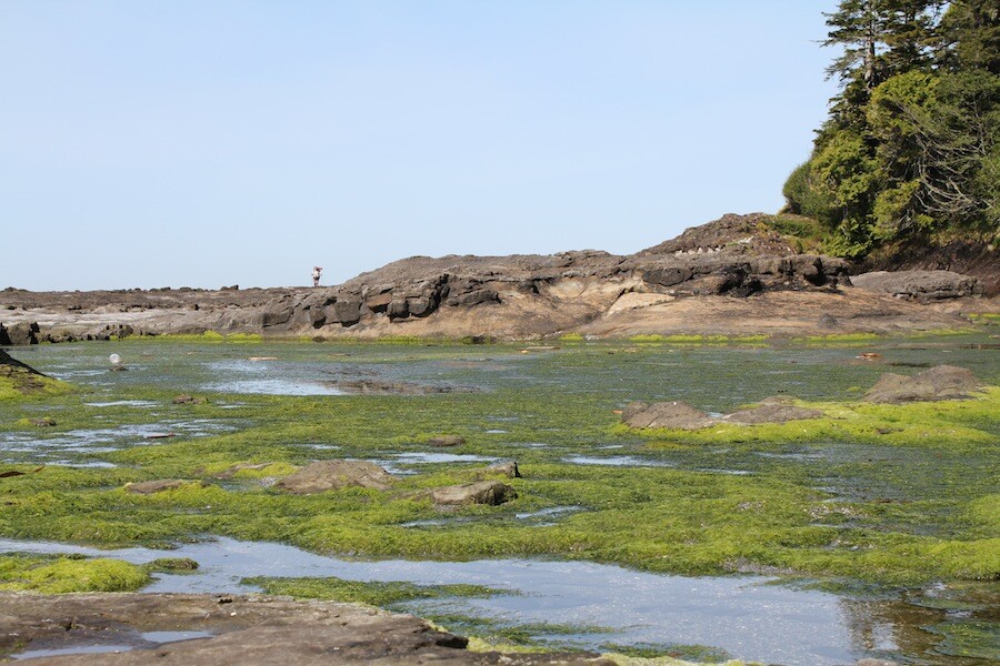
The Graveyard of the Pacific
The ‘Graveyard of the Pacific’ is a nickname for the stretch of the coastal region from the northern Oregon coast to Cape Scott Provincial Park on Vancouver Island. Sea torrents are common in this region because of rugged and largely undeveloped coastline, and the area is frequently subject to heavy and unpredictable weather. Over 2000 sea faring vessels and 700 lives have been lost in the area where the Columbia river dissipates into the Pacific ocean alone. Some records state that 484 wrecks happened on the west and south sides of Vancouver island. Combinations of fog, wind, storm, current and waves have crashed hundreds of ships in the region.

Season
The trail is open from May 1, to September 30. The trail itself is 75 km long and runs from Gordon bay to Pachena Bay (south of Bamfield), and start at either end is possible, with bus transportation and a water taxi available to shuttle hikers from one end to the other. It is possible to do the trail when it is not open but Parks Canada does not guarantee the accessibility of services like search and rescue, so parties would have less access to emergency help should they require it. On the off season, it is advisable to carry a Spot device or satellite phone for safety.

When to go
The best time of year to go is during the least rainy months – which on the west coast, number in the few, since they call it the coastal rainforest for a reason! The months of July and August are the least rainy by far, though you can expect rainfall any time of year. We were lucky – we took a trip in early May during a strong high pressure system in the region and experienced 6 days of sunshine and temperatures in the low 20’s Celsius.

Rainfall amounts
July and August the rainfall amounts are 64 and 86 mm respectively, dive into September and the average is 144 mm, and by October is 368 mm up to the rainiest month of all, November at almost 600 mm of rain. The temperatures are rarely hot, even in the summer months, but there is little diurnal variation. In the summertime expect highs of 17 degrees and lows of around 10 degrees Celsius. The heavy humidity will also make it feel much warmer than it is, and when you’re walking, you’ll always get hot due to the humidity.

A very rainy place
Things will cool down substantially during periods of rain, so adequate rain protection is a must. There is plenty of driftwood on the beaches, so having a fire is one of the most enjoyable evening activities. There is nothing like sitting on a beautiful, rugged beach, relaxing in front of a fire, especially on a chillier night. If you do it in less popular months, such as sometime in May and before June 15, there will be much fewer people on the trail and more driftwood available on the beaches.

Consider the shoulder seasons
The advantages of going in the off peak season are numerous. In addition to less people, and a more remote feel, you also don’t have to reserve the trail. Reservations for the trail are not taken until June 15 – so if you would like to get on the trail before then, you can any time – no reservations are required and no quotas are in place. In the busy season, the park restricts trail the number of users accessing the trail every day. Reservations are required for peak hiking seasons, between June 15 and September 15. Between October 1 and April 30, overnight use of the trail is not recommended because of prolonged periods of heavy rainfall, strong winds, high tides and shorter daylight hours.

What will it cost?
There is a fee to hike the trail. An individual trail hiking permit costs $127.50, plus add $16 for the water taxi at Gordon River, and another $16 for the crossing at Nitinat Narrows, per person. This will cost a total of about $160 per person in fees.
Transportation & Logistics
The trail bus, the West Coast Trail Express will take you from the Pachena Bay trailhead to the Gordon River trailhead in 3.5 hours. The bus also offers service to Victoria and Nanaimo. The bus runs every day between June 15 and September 15. Reservations can be made and are strongly encouraged. The fees to hike the trail aren’t cheap, so be prepared to pay $160 trail fee for each hiker. Add to that transportation to and from the trail or back to your vehicle, and the hike will definitely cost you a little bit.

That being said, the trail fees go towards a good cause and the Parks people do an excellent job of trail and campground maintenance. Maintaining the trail is not easy due to it’s rugged nature, lots of deadfall and lots of moisture, lots of mud and the rapid growth rate of the forest, which swallows trails up very fast. The boardwalks, numerous ladders, as well as cable cars all need to be maintained. If you are concerned about the trail fees and what they go towards, you definitely get what you pay for. Trail work is difficult on this trail, cumbersome and time consuming, and it requires lots of diligence to keep it passable. Without this trail work and the addition of the trail aids, such as boardwalks, cable cars and ladders, hiking this coastline would be impossible.
no images were found
Where to stay before or after the hike
If you want to experience Victoria
Victoria hotel deals on Hotels.ca | Get Up to 60% off Victoria Hotel booking through Agoda.com
If you want to be close to the trail head
Port Renfrew Hotel Deals Finder | Get Up to 60% off Victoria Hotel booking through Agoda.com
Which way should I hike the trail?
You can start the trail either from the north, Pachena Bay start or south end, at Gordon River. Each direction is equally popular, and there is no recommended route. The south end, near Gordon River is much more challenging so you can start there if you want to have the hardest and most gruelling hiking over with. On the other hand, some prefer to start on the easier side from Pachena Bay, and by the time you get to the most difficult parts of the trail your pack is lighter as you eat all your food, and you may be more fit after several days of hard backpacking. You also might be more tired and have more blisters.

In the end it’s up to you – do you want to do the hardest hiking first or last? The trails at the south end are much more grueling, muddier and more ladders and cable cars. Travel is slow, and in parts you can expect to cover only 1 km per hour. As you head further north along the trail, hiking conditions improve, and you can travel 3 km per hour and faster as you head further. Some of the hiking is so slow it is very mentally defeating, not to mention physically. To have to hike around mud bog after mud bog it is not nice to see huge ladders descending into a massive ravine, only to have to come up all of them on the other side. Whew!
Ready to go?
We hiked the trail during the start of the official season, in mid-May. Read our trip report to see more photos and get more tips and ideas for planning your own hike.

- How to experience the world while isolated at home - April 21, 2020
- How to prevent and treat hypothermia - February 21, 2019
- How to layer with your down jacket - November 28, 2018
We write rarely, but only the best content.
